Stansted Airport is approximately 40 miles (64 km) by road from central London, though the exact figure changes with your London starting point and your route. In a straight line it is only about 31 miles (50 km). The airport sits in Essex, north-east of London, next to Stansted Mountfitchet — and despite carrying "London" in its name, it is well outside Greater London by geography.
That gap between 40 and 31 miles explains most of the confusion around this question. Road distance runs roughly 29% longer than straight-line on this corridor — the M11 does not travel in a straight line, and neither does London. This guide gives consistent, methodologically honest distances and explains why published figures disagree. Pre-booked transfers to Stansted are available from Stansted Airport Taxi, a TfL-licensed private-hire operator, with fares calculated on the actual road distance. Distances last verified August 2026.
Quick Distance Reference — Stansted Airport
The key figures before the detail. Straight-line and road distances are not interchangeable — this table shows both where available.
| Destination |
Straight-line |
By road |
Note |
| Central London | ~31 miles (50 km) | ~40 miles (64 km) | Reference point required — see detail below |
| Cambridge | ~22 miles (36 km) | ~30 miles (48 km) | Closer than central London |
| Bishop's Stortford | ~4 miles (7 km) | — | Nearest town |
| Harlow | ~10 miles (16 km) | — | M11 corridor |
| Colchester | ~27 miles (44 km) | — | A120 corridor |
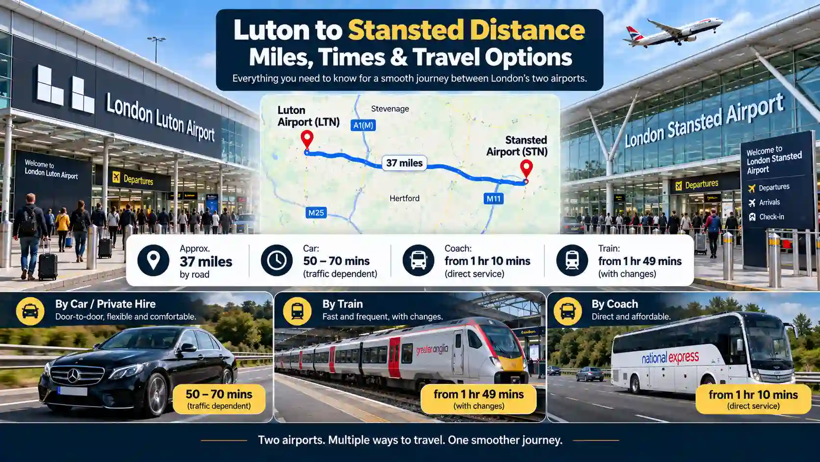
| London Luton (LTN) | — | ~27 miles (43 km) | Nearest London airport by road |
| London City (LCY) | — | ~28 miles (45 km) | Airport reference points |
| London Southend (SEN) | — | ~29 miles (47 km) | Airport reference points |
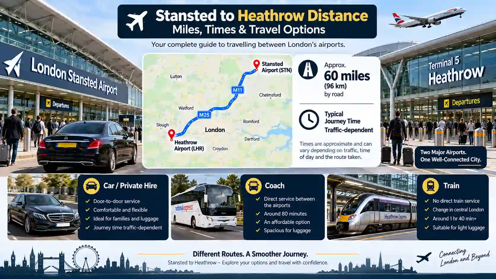
| London Heathrow (LHR) | — | ~42 miles (68 km) | Airport reference points |
| London Gatwick (LGW) | — | ~54 miles (87 km) | Furthest London airport — route crosses/circles London |
| Birmingham Airport (BHX) | — | ~93 miles (150 km) | Airport reference points |
The most important distinction on this page. Straight-line figures and road figures are not interchangeable — for Stansted to central London the road is roughly 29% longer than the straight line. Any source giving a single distance figure without specifying which type it is may be mixing the two. The methodology section below explains how these figures were measured.
⚙ Quick Answer: How Far Is Stansted Airport from London?
About 40 miles (64 km) by road from central London — the figure to use for any actual journey planning. In a straight line it is around 31 miles (50 km), useful for understanding geography but not for planning a drive.
The exact road figure varies by your London starting point and route. East London reference points (Liverpool Street, Canary Wharf, Stratford) are closer — around 30 miles by road. West London reference points (Paddington, Victoria) are further, because the journey crosses the city rather than approaching its edge.
For journey time — which is the question most people actually want answered — use neither figure. On the M11 corridor, time is governed by traffic rather than by miles. A 40-mile trip can take one hour or two and a half, depending entirely on conditions.
Quick Answers
How many miles is Stansted Airport from London?
About 40 miles (64 km) by road from central London. In a straight line it is approximately 31 miles (50 km). The road figure is roughly 29% longer because the M11 does not travel in a straight line and London is an area, not a point.
Is Stansted closer to London or Cambridge?
Cambridge — 22 miles straight-line and about 30 by road, against 31 miles straight-line and about 40 by road to central London. This surprises people who think of Stansted as a London airport.
What postcode is Stansted Airport?
CM24 1RW. The airport is in Uttlesford, Essex, immediately adjacent to Stansted Mountfitchet and about 4 miles from Bishop's Stortford. It is outside Greater London despite carrying London in its name.
Which London airport is closest to Stansted?
London Luton, at about 27 miles by road. London City follows at about 28 miles and Southend at 29 miles. Heathrow is about 42 miles and Gatwick about 54 — both involve crossing or circling London.
How far is Stansted Airport from Liverpool Street?
Liverpool Street is the Stansted rail terminus. Geographically it sits within the City of London, so the straight-line distance is about 30 miles — among the closest of any central London reference point. Road distance is around 35–38 miles depending on route.
Why do websites give different distances for Stansted?
Four reasons: road versus straight-line measurement, different London reference points, different routes selected by planning tools, and rounding. Both "40 miles" and "31 miles" are correct answers to the same question — they measure different things.
Where Is Stansted Airport? Location and Geography
Before any distance means anything, it helps to know exactly what is being measured from — and to distinguish between three things that share the same name.
The Airport's Actual Location
London Stansted Airport sits in Uttlesford, Essex, in the East of England, roughly north-east of London. Its postcode is CM24 1RW. The airport is accessed from M11 Junction 8, with a short link road of about two miles connecting the motorway to the terminal — which is why the airport is often described as being on or adjacent to the M11. The nearest settlement is Stansted Mountfitchet, and the nearest town of any size is Bishop's Stortford, about 4 miles away in a straight line. Harlow is about 10 miles to the south-west and Chelmsford about 14 miles to the south-east.
Stansted, Stansted Mountfitchet and the Airport Are Three Different Things
This distinction catches people out constantly. London Stansted Airport is the airport itself, on the Essex side of the county boundary. Stansted Mountfitchet is a village in Essex, immediately north-west of the airport, with its own railway station on the West Anglia Main Line. "Stansted" in casual use almost always means the airport, but in a postal address or on a map it may refer to the village — two places a few miles apart with overlapping names. A distance quoted "to Stansted" can therefore mean either. Always check which.
The Relationship with London
The airport carries London in its name but sits well outside Greater London — in a different county (Essex), under a different local authority (Uttlesford), and without any administrative connection to the capital. It is a London airport by function, by naming convention and by the fact that it serves London's travel demand. It is not a London airport by geography. That single fact accounts for most of the surprised reactions to the journey length: passengers see "London Stansted" and expect a short ride into the city. The honest answer is 40 miles by road — comparable to a long drive across Greater London itself.
The Relationship with the East of England
Geographically Stansted belongs to the East of England far more than to London. It is closer to Cambridge (22 miles straight-line) than to central London (31 miles), and closer still to Chelmsford, Harlow and Braintree. For travellers from Essex, Hertfordshire, Suffolk and Cambridgeshire, Stansted is the local airport. For passengers starting in south or west London, it is a long way out — and for much of west London, Heathrow is actually closer. The airport's geographical alignment is north-east, which means east and north-east London are the best-served parts of the city, and west and south-west London are the worst-served.
How Far Is Stansted from Central London? Distance by Reference Point
There is no single answer because London is an area rather than a point. These figures demonstrate the pattern — eastern London is closer, western London is further.
| London Reference Point |
Straight-line from Stansted |
Why It Matters |
| Stratford | Closest — east London, on the direct Stansted corridor | Most frequent National Express coach stop; A9 coach terminal |
| Canary Wharf | Similar to the City — east London / Docklands | Financial district; east of the city facing Stansted |
| City of London | ~30 miles (48.5 km) | Eastern side of centre — the shortest central London measurement |
| Liverpool Street | ~30 miles (48 km) | Stansted rail terminus; within the City geographically |
| London Bridge | ~30–31 miles | Just south of the City, eastern side |
| King's Cross | ~31 miles | North of centre — slightly closer than Westminster |
| Westminster | ~32 miles (51 km) | Central reference; further west adds distance |
| Victoria | ~32 miles | Coach and hotel district; same broad area as Westminster |
| Paddington | Above 32 miles — western central | Most western of central reference points; road distance noticeably longer |
The pattern these points reveal. Eastern London reference points (Stratford, Canary Wharf, the City, Liverpool Street) are closest to Stansted — around 30 miles straight-line. Western ones (Paddington, Victoria) are further, because the journey has to cross the city rather than approach its edge. The spread across central London alone is two to three miles straight-line, and considerably more by road once the cross-London element is added. Any page giving one universal "distance to London" is choosing a reference point without disclosing it.
How Far Is Stansted from Different Parts of London?
The geographical pattern by area — more useful than individual landmarks if you live somewhere that is not on a tourist map.
| London Area |
Approximate Straight-line |
Airport Relationship |
Nearest Airport |
| North-East London | ~22–28 miles | Best-placed — Stansted faces directly; road avoids crossing the city | Stansted |
| East London | ~28–32 miles | Very well placed — direct corridor, no city crossing | Stansted / London City |
| North London | ~28–33 miles | Good — M11 approach from north-east, North Circular connects | Stansted or Luton |
| Central London | ~30–32 miles | Moderate — depends on east/west position within the centre | Stansted (east) or Heathrow (west) |
| South-East London | ~33–38 miles | Moderate — route involves A406 or a crossing; adds time | Stansted or Southend |
| South London | ~38–42 miles | Noticeably further; road adds significantly more than the map suggests | Gatwick for many areas |
| West London | ~40–48 miles | Furthest area — opposite side of the city; cross-London journey | Heathrow |
The practical takeaway. If you live in east, north-east or north London, Stansted is closer than the headline "40 miles" figure suggests — and the road journey is proportionally shorter because it avoids crossing the city. If you live in west or south-west London, both the straight-line and the road distance are at their longest, and the drive is disproportionately longer still because it runs against the grain of the road network. For much of west London, Heathrow is closer and faster; for much of south London, Gatwick is.
How Far Is Stansted from Major UK Towns and Cities?
Destinations with a genuine relationship to Stansted — the East of England region the airport actually belongs to, plus further afield.
| Destination |
Straight-line |
By road |
Note |
| Bishop's Stortford | 4 mi (7 km) | — | Nearest town; West Anglia Main Line |
| Saffron Walden | 9 mi (15 km) | — | Local Essex |
| Harlow | 10 mi (16 km) | — | M11 corridor; 24-hr bus route |
| Braintree | 12 mi (20 km) | — | A120 corridor |
| Chelmsford | 14 mi (22 km) | — | Local Essex; regional bus routes |
| Epping | 15 mi (24 km) | — | M11 corridor |
| Brentwood | 19 mi (30 km) | — | Local Essex |
| Cambridge | 22 mi (36 km) | ~30 mi (48 km) | M11 direct — closer than central London |
| Enfield | 22 mi (36 km) | — | North London — same distance as Cambridge |
| Colchester | 27 mi (44 km) | — | A120 corridor |
| Luton (town) | 29 mi (47 km) | — | Different from Luton Airport |
| Southend-on-Sea | 31 mi (50 km) | — | Same straight-line as central London |
| Watford | 32 mi (52 km) | — | West of London; M25 route |
| Bedford | 35 mi (57 km) | — | — |
| Ipswich | 40 mi (64 km) | — | A120/A12 corridor |
| Peterborough | 52 mi (84 km) | — | — |
| Birmingham | — | ~125 mi (200 km) | M11–A14–M6 corridor; ~2 hr 10 min clear |
Cambridge is the headline regional relationship. At 22 miles straight-line and around 30 by road, it sits closer to Stansted than central London does. For travellers visiting Cambridge from Stansted, or Stansted from Cambridge, the M11 provides a direct, mostly single-road connection. The airport serves Cambridge travellers as naturally as it serves east London.
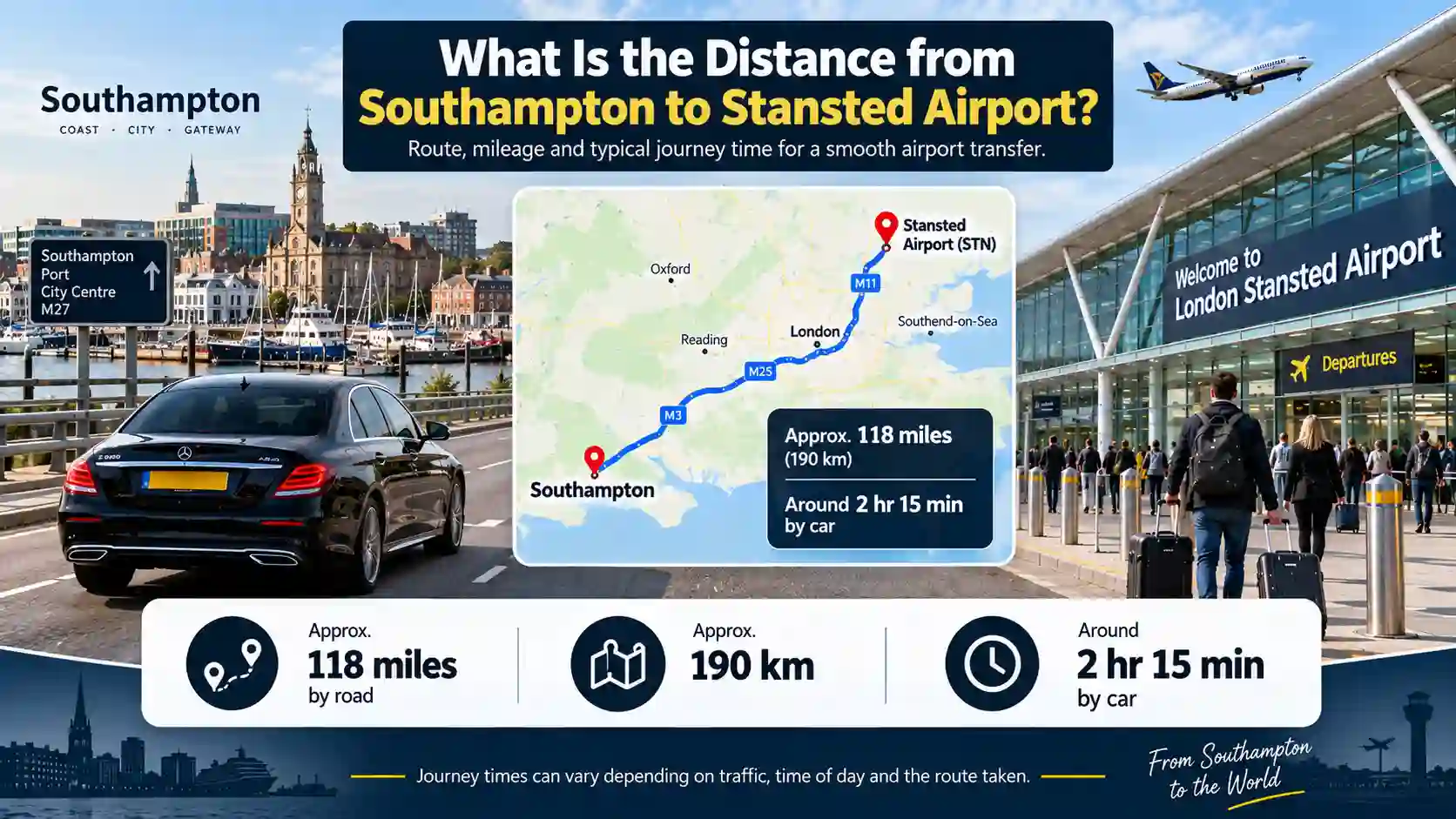
Midlands, south and northern England. Birmingham is roughly 125 miles by road and around two hours and ten minutes in clear conditions via M11–A14–M6. Oxford, Reading, Brighton, Southampton and Portsmouth all involve the M25 or a cross-country route — both add distance beyond what a map suggests, because the journey has to get around London rather than through it. Leeds and Manchester are long-distance relationships where the road network dictates everything and straight-line distance means little for planning.
Full Stansted Distance Reference Table
Consolidated figures for consistent comparison. Blank cells mean the figure was not available from a single consistent source — cells are left empty rather than filled with a figure measured differently.
| Destination |
Straight-line |
By road |
Note |
| Bishop's Stortford | 4 mi (7 km) | — | Nearest town |
| Saffron Walden | 9 mi (15 km) | — | Local |
| Harlow | 10 mi (16 km) | — | M11 corridor |
| Braintree | 12 mi (20 km) | — | A120 corridor |
| Chelmsford | 14 mi (22 km) | — | Local Essex |
| Epping | 15 mi (24 km) | — | M11 corridor |
| Brentwood | 19 mi (30 km) | — | Local Essex |
| Cambridge | 22 mi (36 km) | ~30 mi (48 km) | M11 direct |
| Enfield | 22 mi (36 km) | — | North London |
| Colchester | 27 mi (44 km) | — | A120 corridor |
| London Luton (LTN) | — | 27 mi (43 km) | Nearest London airport by road |
| London City (LCY) | — | 28 mi (45 km) | Airport reference points |
| Islington | 29 mi (47 km) | — | North London |
| London Southend (SEN) | — | 29 mi (47 km) | Airport reference points |
| Luton (town) | 29 mi (47 km) | — | Different from Luton Airport |
| City of London | 30 mi (48.5 km) | — | Shortest central London reference |
| Central London | ~31 mi (50 km) | ~40 mi (64 km) | Reference point required |
| Southend-on-Sea | 31 mi (50 km) | — | — |
| Westminster | 32 mi (51 km) | — | West of City; road adds more |
| Watford | 32 mi (52 km) | — | — |
| Bedford | 35 mi (57 km) | — | — |
| Croydon | 39 mi (62 km) | — | South London |
| Ipswich | 40 mi (64 km) | — | — |
| London Heathrow (LHR) | — | 42 mi (68 km) | Airport reference points |
| Slough | 45 mi (73 km) | — | West of London |
| Peterborough | 52 mi (84 km) | — | — |
| London Gatwick (LGW) | — | 54 mi (87 km) | Furthest London airport |
| Birmingham Airport (BHX) | — | 93 mi (150 km) | Airport reference points |
Distances last checked: August 2026. All figures are approximate geographical references, not measurements of a specific journey from a specific address.
How Far Is Stansted from the Other London Airports?
Road distances between airport reference points — the only measurement that means anything for inter-airport comparisons.
| From Stansted to |
Road distance |
Why the route is that length |
| London Luton (LTN) | ~27 miles (43 km) | Northern edge of London — route avoids crossing the city |
| London City (LCY) | ~28 miles (45 km) | East London — direct corridor, short route |
| London Southend (SEN) | ~29 miles (47 km) | North-east of London — A120/A127 corridor |
| London Heathrow (LHR) | ~42 miles (68 km) | West London — involves M25 or crossing London; adds significantly |
| London Gatwick (LGW) | ~54 miles (87 km) | South of London — furthest airport; M25 route circles London entirely |
What the ordering shows. Luton, London City and Southend cluster within a couple of miles of each other, all under 30 miles by road. They share the same reason: all three sit around the northern and eastern edge of the London region, as Stansted does, so the routes between them avoid crossing the city. Heathrow sits to the west and Gatwick to the south — reaching either from Stansted means the M25 or a central London transit. A 27-mile trip to Luton and a 54-mile trip to Gatwick do not differ by a factor of two in travel time, because the road network between them is fundamentally different in character.
Airport-to-airport road distance is a poor guide to journey time. Every route between London airports involves either the M25 or central London traffic. Journey times for inter-airport connections are covered separately — a distance figure tells you very little about how long the drive will actually take.
Why Do Published Stansted Distances Disagree?
If you have compared two sources and found two different answers, neither is necessarily wrong. Four things vary between them.
| Cause |
How Much It Affects the Figure |
Example |
| Road vs straight-line | Largest — ~29% on this corridor | 31 miles straight-line vs 40 miles by road to central London |
| Reference point for 'London' | 2–3 miles across central points | City of London ~30 miles; Westminster ~32 miles — both correct |
| Route selected | Several miles between options | Same journey shows as 40 or 43 miles depending on planner |
| Rounding and age | 5–10 miles for coarsely rounded figures | 'About 40 miles' may be a rounded 38 or 43; many figures have not been rechecked in years |
Road vs straight-line is the dominant cause. On the Stansted to central London corridor, road distance is roughly 29% longer than straight-line. That ratio is not constant — it depends on how directly the road network connects the two points. Cambridge shows a similar ratio (22 miles straight-line, ~30 by road) because the M11 runs at a slight angle. For destinations that require circling London, the road ratio is even higher.
Both "40 miles" and "31 miles" are correct answers to "how far is Stansted from London" — they measure different things. The confusion arises when a figure is stated without specifying which type it is. Always check. The relevant one for any actual journey is the road distance. The relevant one for understanding geography is the straight-line figure.
Road Distance vs Straight-Line: Which Should You Use?
The choice depends on what you are trying to do — and for planning an actual journey, neither is the right figure.
- Use straight-line distance for: understanding geography; comparing which of two places is nearer to the airport; getting a rough sense of where Stansted sits relative to a region. It is the honest answer to "how far away is it" in the abstract, and the figure that explains why Cambridge is closer than central London.
- Use road distance for: anything involving an actual journey — fuel calculations, route planning, comparing transfer options and fares, or getting a realistic sense of how far a drive actually is. Straight-line distance is useless for this because you cannot drive it.
- Use neither for journey time. This is the most important point on the page. Distance and duration are different questions, and on the M11 corridor they diverge sharply. A 40-mile trip from central London can take an hour or well over two, depending on the M11, the M25 and the time of day. Distance tells you nothing reliable about how long a journey will take on this route.
- Use a pre-booked transfer fare for the most accurate total cost. Fares from Stansted Airport Taxi are calculated on the actual road distance from your specific address, not a rounded estimate or a central London average. Your fixed fare is confirmed at booking — call +44 20 3617 7825 or book online.
How These Distances Were Measured
Being explicit about methodology matters — because the whole page argues that methodology is exactly what makes published figures disagree.
- Straight-line figures are measured from the London Stansted Airport reference point to the named place, using a single consistent source throughout. Using one source matters more than using the "best" individual source for any single row, because mixed sources produce a table that cannot be compared internally — you end up comparing apples measured by one ruler with oranges measured by another.
- Road figures are driving distances between reference points, again from a single consistent source. Where a road figure could not be sourced consistently for a given destination, the cell is left blank rather than filled with a figure measured a different way. A blank is more useful than a misleading number.
- What is not on this page. Journey times, route recommendations and traffic conditions are separate questions with separate pages. Mixing them into a distance table is precisely how published figures became confusing in the first place — a distance sourced from one tool and a time sourced from another under different conditions are not comparable. All figures should be treated as approximate geographical references, not measurements of a specific journey from a specific address.
- Review date. Distances are geographically stable but published sources and routing tools change. This page was reviewed in August 2026 and is scheduled for review in February 2027.
Related Stansted Airport Guides
The questions that follow naturally from knowing the distance.
Frequently Asked Questions
Q: How far is Stansted Airport from London?
A: About 40 miles (64 km) by road from central London, or roughly 31 miles (50 km) in a straight line. The road distance is what matters for any actual journey. The straight-line figure explains why different sources give different answers — the M11 does not travel in a straight line, and "London" is an area rather than a point.
Q: Where exactly is Stansted Airport?
A: In Uttlesford, Essex, in the East of England, north-east of London, with postcode CM24 1RW. The nearest village is Stansted Mountfitchet and the nearest town is Bishop's Stortford, about 4 miles away. The airport is accessed from M11 Junction 8, with a short link road to the terminal.
Q: Is Stansted Airport in London?
A: No. It carries London in its name but sits well outside Greater London, in Essex. It is a London airport by function and naming convention rather than by geography — which is why the journey surprises passengers who expect something shorter based on the name.
Q: How far is Stansted from Cambridge?
A: About 22 miles (36 km) in a straight line and roughly 30 miles (48 km) by road. Cambridge is closer to Stansted than central London is — which surprises people who think of it purely as a London airport. The M11 provides a direct, mostly single-road connection between the two.
Q: Which London airport is closest to Stansted?
A: London Luton, at about 27 miles by road. London City follows at about 28 miles and Southend at about 29 miles. All three share the same reason for being close: they all sit around the northern and eastern edge of the London region, as Stansted does, so the routes between them avoid crossing the city.
Q: Why do different websites give different distances for Stansted?
A: Four reasons: road versus straight-line measurement (the biggest cause — a ~29% difference on this corridor), which reference point was used for "London", which route the planning tool selected, and rounding of figures that may not have been rechecked in years. Both "40 miles" and "31 miles" are correct — they measure different things.
Q: Is Stansted closer to London or Cambridge?
A: Cambridge, in a straight line — 22 miles against 31 to central London. By road the gap narrows but Cambridge remains closer at roughly 30 miles against 40. This reflects the airport's geographic position in the East of England rather than its London branding.
Q: Which distance should I use to plan my journey to Stansted?
A: Road distance for any actual journey — straight-line distance is useful for understanding geography but you cannot drive it. And for timing a journey, use neither: distance and duration are different questions on this corridor. On the M11, time is governed by traffic rather than by miles.
Pre-Booked Transfer to Stansted — Fares Based on Actual Road Distance
The most useful thing on this page is not any single number — it is the gap between the straight-line figure and the road figure. Stansted is 31 miles from central London in a straight line and about 40 by road. That 29% difference is why a map underestimates the journey, why published figures disagree, and why timing matters more than distance on this corridor. Stansted Airport Taxi, a TfL-licensed private-hire operator, calculates fares on the actual road distance from your specific address — not a rounded estimate or a central London average. Your fixed fare is confirmed at booking so there are no surprises when you arrive.
- ✔ Fixed fare calculated on actual road distance from your address — not a rounded or averaged figure
- ✔ 24/7 operation including pre-dawn departures and late-night arrivals when trains are not running
- ✔ Meet & greet in the arrivals hall, flight tracking and 45–60 min free waiting on every arrivals job
- ✔ Saloon, Estate, MPV5–8 and Executive vehicles — luggage help from door to terminal
👉 Get your fixed-fare quote in under two minutes — book online or call +44 20 3617 7825.
See also our Trains & Rail Guide, Coaches & Buses Guide, and Car Hire Guide.
Last reviewed August 2026 · Next review February 2027 — distances are geographically stable but published sources and routing change · Sources: London Stansted Airport; National Highways — M11 · Stansted Airport Taxi editorial team.