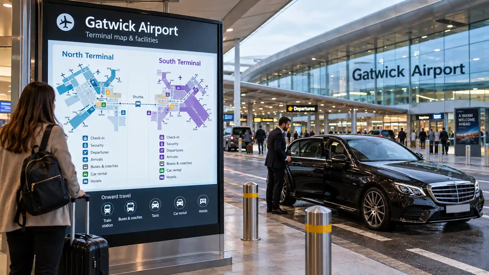
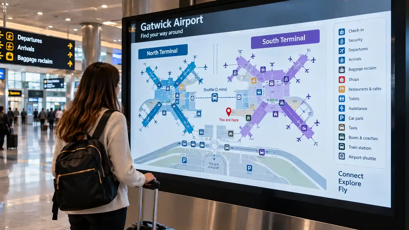
Gatwick has two entirely separate passenger terminals — North and South — each with its own road access, check-in, security, arrivals and departure facilities. The single most important thing to confirm before planning any journey to or from Gatwick is which terminal your flight actually uses.
This page covers the airport-wide picture: where Gatwick is, how North and South Terminal relate, the roads and railway, and how to use the map before you travel. For detailed internal navigation of each terminal, see our dedicated Gatwick North Terminal Map and Gatwick South Terminal Map pages.
⚙ Quick Answer: How Is Gatwick Airport Laid Out?
Gatwick is in West Sussex, near Crawley, roughly 28 miles south of central London — the southernmost of the major London airports, reached via the M23 and A23 south of the M25.
North Terminal sits at the northern end of the site (easyJet, Norwegian, TUI and others). South Terminal sits at the southern end (British Airways, Vueling and others) and is directly connected to the Gatwick railway station — the primary rail-access point for the whole airport. They're genuinely separate buildings with their own check-in, security, arrivals and departures, sharing only the airfield and an inter-terminal transit shuttle.
Confirm your terminal before anything else — before booking transport, before a taxi pickup or drop-off, before planning a rail connection. Check your booking confirmation, boarding pass, or the airline's app.
Gatwick Airport Map: What Is Where?
The airport-wide picture, before any terminal-level detail.
| Airport element |
Map purpose |
| North Terminal | Passenger terminal orientation — northern airport site |
| South Terminal | Passenger terminal orientation — southern airport site, adjacent to railway station |
| Railway station | Rail access orientation — South Terminal position |
| Airport roads | Vehicle approach — M23/A23 access |
| Arrivals | Passenger arrival orientation — within each terminal |
| Departures | Passenger departure orientation — within each terminal |
| Gates | Airside departure orientation — within each terminal's departure area |
| Ground transport | Onward journey orientation — varies by terminal |
| Taxi/private-hire areas | Road-transfer orientation — terminal-specific drop-off and pickup |
| Inter-terminal transit | Connection between North and South Terminals |
Quick Answers
Where is Gatwick Airport on a map?
In West Sussex, South East England, approximately 28 miles south of central London, near Crawley on the M23/A23 corridor south of the M25.
How many terminals does Gatwick have?
Two — North Terminal and South Terminal. Separate buildings at the same site, connected by an inter-terminal transit shuttle.
Where is Gatwick's railway station?
Directly connected to South Terminal, with services to London Victoria, London Bridge and other destinations.
Are North and South Terminal separate?
Yes — separate check-in, security and departure facilities, sharing only the airfield and the inter-terminal transit.
How do I know which terminal I need?
Check your booking confirmation, the airline's app, or your boarding pass. Terminal assignments are generally consistent by airline but can change.
Where do taxis drop off at Gatwick?
At the designated drop-off zone on each terminal's own forecourt — North and South have separate zones, reached from separate road circuits.
Gatwick Airport Map: What Does It Show?
Airport-wide orientation, not internal terminal detail.
Airport-wide orientation. The map shows the overall airport boundary and the relationship between its main components — the two terminal buildings, the main road approaches, the railway station, major ground transport areas, and the airport's general orientation within the surrounding road network. It doesn't show internal terminal detail — check-in zones, individual gates, or lounge positions belong to the terminal-level maps for each building. The airport map answers where things sit relative to each other at the airport level, not what's inside each facility.
Terminal orientation. Both terminals sit at the same airport site but are separate buildings, connected by an inter-terminal transit system. Knowing which terminal applies to your journey is the most important decision the airport-wide map supports — once confirmed, the relevant terminal map provides the internal navigation detail.
Access and transport orientation. The map also shows the major access infrastructure — the M23/A23 approach, the railway station position, and the ground transport areas serving both terminals. Understanding the geographic relationship between these and the terminals is useful for planning your approach by any transport mode.
Where Is Gatwick Airport?
The geographic picture before the terminal-level detail.
Gatwick sits in West Sussex, South East England, near the town of Crawley, approximately 28 miles south of central London — the second largest UK airport by passenger volume, after Heathrow. Geographically, it lies between London to the north and Brighton to the south, on the edge of the Crawley urban area. The M23 motorway and the A23 road provide the primary access, running south from the M25 London orbital.
Gatwick and London. At roughly 28 miles south, Gatwick is the southernmost of the major London airports — further from London than Heathrow (~15 miles west) but closer than Stansted (~50 miles north). For passengers from south and south-east London, it's typically the closest major airport. Its position on the main London–Brighton road and rail corridor gives it strong ground transport connections to central London.
On Google Maps. Search "Gatwick Airport" or "London Gatwick Airport" to see its geographic position in West Sussex, the M23/A23 approach routes, the North and South Terminal positions, the railway station, and surrounding road access. Google Maps is the practical tool for planning the road journey there — current routing, journey times and traffic. For navigation within the airport itself, the airport's own maps and signage are more appropriate.
Gatwick Airport Layout
Two terminals, one airfield, one transit connecting them.
North Terminal
At the northern end of the site, serving airlines including easyJet, Norwegian, TUI and other carriers, with its own road access, drop-off zone, short-stay car park and transport connections. On the airport-wide map, it's the upper of the two terminal buildings, with its dedicated approach and parking positioned around the northern part of the site.
South Terminal
At the southern end of the site, serving airlines including British Airways, Vueling and other carriers — and directly adjacent to Gatwick's railway station, which connects to London Victoria and London Bridge. On the map, South Terminal sits in the southern section, with the station shown directly alongside the building.
How They Relate
Genuinely separate passenger facilities — their own check-in halls, security checkpoints, departure areas and arrivals facilities — sharing only the same airfield and runway system. You must use the terminal matching your flight; check the booking confirmation, boarding pass or airline app. The inter-terminal transit shuttle connects them for passengers who need to move between terminals — for example, connecting flights — but shouldn't be relied on to compensate for arriving at the wrong terminal at the last minute.
Gatwick Airport Terminals Map
What each terminal-level map helps you identify.
| Terminal |
What the map helps you identify |
| North Terminal | Terminal location, road access, drop-off and parking orientation, inter-terminal link |
| South Terminal | Terminal location, railway station position, road access, transport orientation |
At the airport-wide level, the North Terminal map shows its position at the northern end of the site, dedicated road access from the A23/M23, the drop-off zone and car parks, and the inter-terminal transit to South Terminal. For detailed North Terminal navigation — check-in, security, the departure area, gates, arrivals, parking and drop-off — see our Gatwick North Terminal Map page.
The South Terminal map shows its position at the southern end of the site, its direct connection to the railway station, road access from the M23/A23, and its drop-off and car parking areas. For detailed South Terminal navigation, see our Gatwick South Terminal Map page.
Gatwick Airport Roads & Approach Map
One approach, then a split into two separate terminal road circuits.
The principal approach is via the M23, connecting from the M25 at Junction 7 (south of Reigate) and running south to the airport. The A23 provides an alternative approach, connecting Gatwick to London and Brighton along the main road corridor. From the M23, the airport is reached via Junction 9 for the main access road — signs for North and South Terminal appear on the approach roads before the airport entrance.
North Terminal road access is reached from the airport's northern road system, off the main access junction on the A23/M23 approach — road signs direct vehicles to North Terminal separately from South Terminal from the junction point. Drivers heading for North Terminal shouldn't enter the South Terminal road circuit, and vice versa. South Terminal road access comes from the southern part of the airport road system, which also leads to the railway station, positioned immediately alongside the terminal building.
Drop-off orientation. Both terminals have designated drop-off zones on their own forecourts. Getting the terminal right matters — dropping a passenger at the wrong terminal before a flight means using the inter-terminal transit to reach the correct departure facility, adding time to the process. Confirm the correct terminal and drop-off zone before arriving, and check current drop-off charges on the Gatwick Airport website before travel.
Gatwick Airport Railway Station & Ground Transport Map
One railway station, two terminals — only one directly connected.
The Gatwick railway station sits adjacent to South Terminal, physically connected to the building — one of the busiest airport railway stations in the UK, with frequent services to London Victoria, London Bridge and other destinations. On the airport map, it appears as part of the South Terminal complex. Passengers arriving by train disembark at the station and access South Terminal directly; to reach North Terminal, they use the inter-terminal transit from the South Terminal area. North Terminal passengers travelling by rail should factor the transit into their journey plan.
Bus and coach. Services use dedicated areas at both terminals — National Express and other operators serve both, with separate stands at each. Coaches don't always serve both terminals on the same route, so confirm the departure or arrival terminal for your specific service before booking.
Taxi and private hire. Designated areas exist at each terminal, with specific pickup and drop-off arrangements differing between them, subject to airport operating rules. Passengers using pre-booked private hire — including Stansted Airport Taxi for long-distance or connecting transfers — should confirm the correct terminal and follow the current airport instructions for private-hire collection.
Gatwick Airport Map: Arrivals & Departures
Each terminal runs its own complete process — there's no shared facility.
Departures. Departing passengers enter via the relevant terminal's departures entrance — check-in, bag drop and the security checkpoint sit on the departure side, with the airside departure area and gates beyond security. On the airport-wide map, the departures process sits entirely within each terminal building; there's no shared departures facility between North and South.
Arrivals. Arriving passengers exit via the arrivals hall of the relevant terminal — both terminals have their own baggage reclaim, customs and arrivals exits. Onward-transport connections differ by terminal: South Terminal arrivals have direct access to the railway station; North Terminal arrivals use the inter-terminal transit for rail access, or the North Terminal road and transport infrastructure directly.
Arrivals vs departures on the map. Departures are typically on an upper level, arrivals on a lower or ground level — this vertical distinction within each terminal is shown on the terminal-level maps rather than the airport-wide one.
Gatwick Airport Gate Map
Gates belong to the terminal-level maps, not the airport-wide one.
Gates sit within the airside departure areas of each terminal, beyond the security checkpoint — check-in, bag drop and security must be completed first. The overall airport map doesn't show individual gate positions; those are on the terminal maps. Gates are numbered, and the specific gate for any flight is shown on departure information screens within the terminal.
Finding your gate: gate information is displayed on screens throughout the airside departure areas, typically confirmed from approximately 45 to 60 minutes before departure — monitor these after clearing security rather than assuming a fixed location, then follow directional signs toward the displayed gate number. Gate distances vary, so allow sufficient time to walk there.
For detailed gate layout at each terminal, see our Gatwick North Terminal Map and Gatwick South Terminal Map pages — South Terminal's gate areas extend into pier and satellite gate structures beyond the main departure lounge.
Which Gatwick Terminal Do I Need?
The single most important check before planning anything else.
Your departure terminal is determined by the airline and shown in your booking confirmation, on the airline's app, and on your boarding pass. Terminal assignments are generally consistent by airline but can change — always check current information rather than relying on a historic assumption.
| Before travelling |
Check |
| Departure | Airline and current flight information for terminal assignment |
| Arrival | Flight information and baggage belt announcement |
| Taxi or private-hire booking | Correct terminal before confirming pickup or drop-off address |
| Drop-off | Correct terminal to avoid wrong-terminal drop-off |
| Pick-up | Correct terminal and current airport pickup instructions |
| Train/coach arrival | How to continue from the station to the relevant terminal |
Confirming the terminal before booking any transport or taxi matters most — a taxi booked to the wrong terminal delivers you to the wrong departure facility.
Gatwick Airport Map for Taxi Pickup & Drop-Off
What the map answers, and what it doesn't.
Before a taxi journey to or from Gatwick, the airport map helps confirm the correct terminal, the road approach to it, and the position of the drop-off or pickup area relative to the terminal entrance — orientation questions. For the operational detail of how drop-off or pickup actually works, follow the current airport instructions and any guidance from your taxi or private-hire provider.
Drop-off orientation. Available at both terminals via designated forecourt zones — the road approach to each is separate, with North Terminal drop-off from the northern road circuit and South Terminal drop-off from the southern circuit. Confirm the correct terminal with your driver before the airport approach, since the road split occurs before the terminal forecourt. Current drop-off charges apply — check the fee on the Gatwick Airport website.
Pickup orientation. For pre-booked private-hire vehicles, pickup follows the airport's current instructions for licensed operators, differing from drop-off — follow the instructions from your service for the confirmed meeting location. For pre-booked Stansted Airport Taxi journeys to or from Gatwick, your driver will confirm the meeting arrangements.
How to Use the Gatwick Airport Map Before Travelling
Six steps, in order.
- 1. Check your flight. Confirm the airline, flight number, departure time, and current terminal assignment from your booking confirmation or the airline's app.
- 2. Identify North or South Terminal. Establish the correct terminal before making any other plans — all subsequent planning (transport, drop-off, parking) depends on it.
- 3. Locate the terminal on the map. Use the airport-wide map to understand its position within the airport, the road access approach, and the general orientation.
- 4. Identify your arrival or departure area. Departing: the departures entrance and check-in area. Arriving: the arrivals exit and onward transport connection.
- 5. Check your transport approach. Car, taxi/private hire, train or coach — confirm the approach serves the correct terminal. The railway station serves South Terminal directly; North Terminal is reached via the inter-terminal transit for rail passengers.
- 6. Check detailed terminal information. Use the Gatwick North Terminal Map or Gatwick South Terminal Map for internal navigation.
Gatwick Airport Map for Different Journeys
Five journey types, each with its own starting orientation.
- Flying from Gatwick: Origin → Airport → Terminal → Check-in/Security → Departure area → Gate. Confirm the departure terminal, locate the correct road approach or transport connection, and identify the departures entrance before travelling.
- Arriving at Gatwick: Arrival terminal → Baggage reclaim → Exit → Onward transport. Confirm which terminal your flight arrives at, then follow signs for the relevant connection — railway, taxi, bus or private hire.
- Meeting someone: Confirm the correct terminal, the arrivals exit, and any agreed meeting arrangement before travelling. Pre-booked private-hire drivers typically meet arriving passengers in the arrivals hall.
- Being dropped off: Confirm the correct terminal before the vehicle enters the airport road system — the road split for North and South drop-off occurs before the terminal forecourts, so your driver needs the terminal confirmed before this junction.
- Being picked up: For a pre-booked pickup, confirm the meeting arrangement with your service provider before leaving baggage reclaim. Pickup arrangements differ by terminal — follow the instructions from your pickup service.
Detailed Gatwick Maps & Related Navigation Pages
Where to go next, depending on what you actually need.
- Gatwick North Terminal Map — detailed spatial navigation of North Terminal, including gates, arrivals, departures, drop-off and parking.
- Gatwick South Terminal Map — detailed spatial navigation of South Terminal, including gates, arrivals, departures, drop-off, parking and the railway station connection.
- Gatwick Airport Lounges — lounge locations, access, prices and booking.
- Gatwick Airport Taxi Pickup & Drop-Off — for pre-booked private-hire transfers, see our booking page below.
Gatwick Airport Map: Quick Reference
Ten common questions, answered directly.
| Question |
Where to look |
| Where is Gatwick Airport? | West Sussex, South East England — M23/A23 road corridor, ~28 miles south of London |
| What terminals does Gatwick have? | North Terminal and South Terminal |
| Where is North Terminal? | Northern end of the airport site — A23/M23 road access |
| Where is South Terminal? | Southern end of the airport site — adjacent to the railway station |
| Where is the railway station? | Directly connected to South Terminal |
| How do I find my gate? | Departure information screens in the airside area of the relevant terminal |
| Where are arrivals? | Within each terminal's arrivals hall — varies by terminal |
| Where are departures? | Within each terminal's departures area — check-in, security and airside |
| Where should a taxi approach? | Correct terminal road circuit — North or South — confirmed before the junction |
| Which detailed map do I need? | North Terminal Map or South Terminal Map — links above |
Frequently Asked Questions
Q: Where is Gatwick Airport on a map?
A: In West Sussex, South East England, approximately 28 miles south of central London. It sits near Crawley, on the M23/A23 road corridor south of the M25 orbital motorway.
Q: Where is Gatwick Airport located in England?
A: West Sussex, South East England — the southernmost of the major London airports, positioned between London to the north and Brighton to the south.
Q: Can I see Gatwick Airport on Google Maps?
A: Yes. Search "Gatwick Airport" or "London Gatwick Airport" on Google Maps to see the airport's position, surrounding roads, and terminal layout.
Q: How do I find Gatwick Airport on Google Maps?
A: Search "Gatwick Airport" in Google Maps. The result shows the geographic location, the M23/A23 approach routes, and terminal positions. Use "Get Directions" to plan a route from any starting point.
Q: What does the Gatwick Airport map show?
A: The airport-wide map shows the positions of North and South Terminals, road access routes (M23/A23), the railway station adjacent to South Terminal, ground transport areas, and the overall airport boundary and layout.
Q: How many terminals does Gatwick Airport have?
A: Two — North Terminal and South Terminal. Separate buildings at the same airport site, connected by an inter-terminal transit.
Q: Where are the North and South Terminals at Gatwick?
A: North Terminal is at the northern end of the airport site. South Terminal is at the southern end, adjacent to the railway station. Both are accessed from the M23/A23 road system, with separate road circuits for each terminal.
Q: Are Gatwick North and South Terminals separate?
A: Yes. North and South Terminals are separate buildings with separate check-in, security, and departure facilities. They share the same airfield and are connected by an inter-terminal transit.
Q: Can I see both Gatwick terminals on one map?
A: Yes. The airport-wide Gatwick map shows both terminals and their relative positions. For detailed internal navigation of each terminal, use the separate North and South Terminal map pages.
Q: How do I know which Gatwick terminal I need?
A: Check the airline's booking confirmation, app, or boarding pass for the departure terminal. If in doubt, contact the airline directly before travelling.
Q: Where is Gatwick Airport railway station?
A: Directly connected to the South Terminal building. It provides services to London Victoria, London Bridge, and other destinations.
Q: Where are the gates at Gatwick Airport?
A: Within the airside departure areas of each terminal, accessed after security. Gate numbers are displayed on departure screens in the airside area from approximately 45 to 60 minutes before departure.
Q: How do I find my gate at Gatwick?
A: After clearing security in the relevant terminal, check the departure information screens for the gate number. Follow directional signs in the departure area to the displayed gate.
Q: Where are arrivals at Gatwick Airport?
A: Within each terminal building. After landing, passengers pass through border control (where applicable), collect baggage from the reclaim carousels, and exit through customs into the arrivals hall of the relevant terminal.
Q: Where are departures at Gatwick Airport?
A: Within each terminal building. Passengers enter the terminal, complete check-in and bag drop, pass through security, and access the airside departure area in the relevant terminal.
Q: How do I navigate Gatwick Airport?
A: Confirm the correct terminal, use the airport-wide map for orientation, then use the terminal-specific map for internal navigation. Overhead signage in the terminal directs passengers through check-in, security, and the departure area.
Q: Where do taxis drop off at Gatwick Airport?
A: At the designated drop-off zones on the forecourt of each terminal. North and South Terminals have separate drop-off areas accessed from their respective road circuits. A drop-off charge applies — check current fees on the Gatwick Airport website.
Q: Where do taxis pick up at Gatwick Airport?
A: Pre-booked private-hire pickups follow the airport's current instructions for each terminal. Confirm the meeting arrangement with the taxi or private-hire service before leaving baggage reclaim.
Q: How do I find the correct Gatwick terminal for my taxi?
A: Check the flight booking confirmation or airline app for the departure or arrival terminal. Confirm this with the taxi or private-hire driver before approaching the airport, as the road split for North and South Terminal occurs before the terminal forecourts.
Gatwick Airport Taxi Pickup & Drop-Off
Once you've confirmed your terminal, Stansted Airport Taxi — a TfL-licensed private-hire operator — provides pre-booked transfers to and from Gatwick, matched to the correct terminal road circuit and pickup arrangement.
- ✔ Fixed fare confirmed at booking — no surge, no surcharge, no card fees
- ✔ Driver confirms the correct terminal and meeting arrangement before your journey
- ✔ 24/7 availability, including early and late connections
- ✔ Saloon through to MPV8 and Executive — matched to your group and luggage
👉 Get your fixed-fare quote in under two minutes — book online or call +44 20 3617 7825.
Find us on Google for directions and reviews.
Last reviewed September 2026 · Next review December 2026 · Airport layout, road access, terminal positions and transport connections at Gatwick Airport are subject to change — always check current official Gatwick Airport information before travelling · Stansted Airport Taxi editorial team, operated by QMH Technologies Ltd (Company No. 13506378, registered office 10–16 Tiller Road, London E14 8PX — verified via Companies House; this is the company's registered office, distinct from its Stansted operational base).